sydney.com.au
Est 1994, Sydney's oldest tourism website

|
|
THE ROCKS WALK

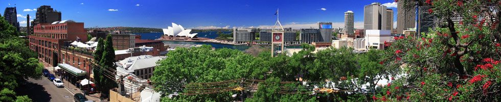
This is the area known as The Rocks. It's not large, but it makes for an easy and fascinating walk due to the history entwined in the streets, laneways and passageways. Picture: ©nzgmw/123RF.COM
Take a self-guided walk through the historic area known as The Rocks
THE ROCKS WALK
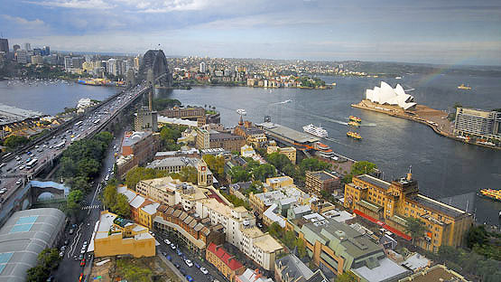
This walk explores The Rocks, the oldest part of Sydney situated on the western shores of Sydney Cove, an area steeped in history. The Rocks was the first European settlement in Australia, established by Captain Arthur Phillip of England in 1788 as a penal colony. The original buildings were built using blocks of local sandstone – hence the name “The Rocks.” To make the most of your walk, you should allow at least half a day, although the walk can be done in much quicker time. If you want to continue on to the steps that lead up to the pedestrian walkway on the harbour bridge, and then leisurely walk across the Harbour Bridge and return by ferry, allow a full day. The harbour bridge part of the walk involves steep areas and steps, so if you have a mobility problem you might prefer to end your walk in The Rocks.
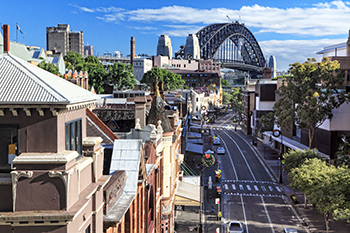
George Street in The Rocks. Picture: ©Leah-Anne Thompson/123RF.com
START AT CIRCULAR QUAY, in Alfred Street, and walk west to George Street. Turn right and you will see the Harbour Bridge in the distance. You are now in The Rocks district.
Continue along George Street and almost immediately on the left is the Russell Hotel. Although now a boutique hotel, it was built in 1887 on the site of what was once a "Moveable Hospital for His Majesty's Distant Possessions" (circa 1790).
Walk on and you'll come to the Fortune of War, which lay claims to the title of Sydney's oldest pub (circa 1828). (Of course the nearby Lord Nelson Brewery Hotel, in Millers Point) also claims to be the oldest licensed hotel in Sydney.
The Fortune of War sits alongside a former bank, which dates back to the early 1880s, and just two doors from Australia's oldest police station, the original Rocks Police Station, which closed in 1974 and is now a museum. (A new police station is situated almost opposite.) You can inspect the cells of the old lock-up, which are much the same as when they were built in 1882.
Next to the historic police station building is an archway that leads to Surgeons Court, the site of where the First Fleet set up its portable hospital. This archway is a portal to an adventurous series of lanes and passageways that make up Nurses Walk.
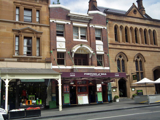
Contender for the crown of Australia's oldest hotel, the Fortune of War.
Next to the police station is an archway that leads to Surgeons Court, the site of where the First Fleet set up its portable hospital. This archway is a portal to an adventurous series of lanes and passageways that make up Nurses Walk. The walkway was created in 1979 to honour the nurses who worked in the hospitals set up in The Rocks in the late 18th century and early 19th century. The site of the colony's first bakehouse can be found here. Small shops and cafes are scattered along the walk.
Nurses Walk runs into Suez Canal, a narrow passageway originally known as Cornwall Lane but which at one point was an open sewer. Understandably, it drew the nickname "Sewers Canal". It was later filled in but for most of the 18th century was the haunt of prostitues and gangsters.
There are some delightful cafes in this vicinity - some of them with outdoor courtyards - accessed by openings off the passageways.
Walk to the end of Suez Canal and, turning right into Harrington Street, you wil notice a series of small cottages built by the former convict William Reynolds in the 1830s. Reynolds was transported for life to Australia from Dublin. The cottages are a great example of the small dwellings of the time.
Turn right into Argyle Street and walk down to George Street. Diagonally opposite the intersection of George and Argyle Streets, at 110 George Street, is Cadmans Cottage, the oldest surviving residential building in Sydney - built in 1816 for the use of coxswains and their crews.
The building is the first to have been built on the shoreline of The Rocks.
From 1845 until 1864, Cadmans Cottage was the headquarters of the Sydney Water Police, then from 1865 to 1970 it became the "Sailor's Hom".
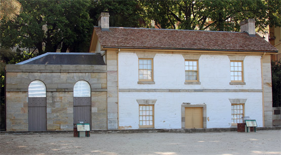
Cadmans Cottage, built in 1816, is the oldest surviving residential building in Sydney. Picture: Julioenrekei, Wikimedia Commons
Restoration of Cadmans Cottage began in 1972 after it was proclaimed a heritage site under the National Parks and Wildlife Act. Control of the site was handed over to the Sydney Cove Redevelopment Authority.
The building is now used as the home for the Sydney Harbour National Parks Information Centre and is open to the public.
After leaving Cadmans Cottage, walk back the way you came and into Argyle Street. After a short walk, on the right you come to Playfair Street, a walkway with an interesting mix of shops, cafes, businesses and former warehouses. On Saturdays and Sundays, between 10am and 5pm, it hosts The Rocks Market. On Fridays, between 9am and 3pm, it hosts The Rocks Friday Foodie Market.
On the left, at Nos. 13-15 Playfair Street, is the "Argyle Terrace", which were built in 1875. The terrace is listed with the NSW government as having "state significance" due to the the style of the buildings and how they were constructed. The terrace is one of the only grouping of modest, speculative type terraces with Italianate details remaining in The Rocks area.
If you look closely you will notice that one of the doorways in the row of terraces provides access to a narrow passgeway. Walk through there and you will be surprised when you discover Foundation Park, a secret area that most Sydneysiders don't know about.
There are lots of passageways in this area to explore from here including Mill Lane on the right and, at the end of Playfair Street, Sydney's tiniest street, Atherden Street, which is 28 metres long and juts up to a sandstone rockface.
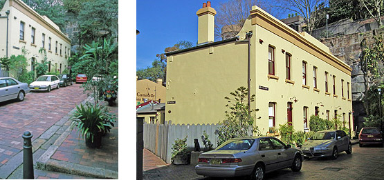 |
Playfair's Terrace, at 1-7 Atherden Street, is a continuous row of four two-storey Victorian terraces built in 1881 and is one of the historic
focal points of Atherden Street, Sydney's shortest Street.
pictures - Wikimedia Commons: (left) Jerrye and Roy Klotz MD, (right) sv1ambo.
Although you wouldn't believe it to look at the above pictures, Atherden Street is linked to an ugly, yet fascinating chapter of Australia's early history. Ben Boyd, born in Scotland, was a London stockbroker who saw commercial opportunities in the new colony. While still in England, he floated the Royal Bank of Australia and in 1842 embarked for Australia, where he quickly became one of the largest squatters (rural landholders) in the colony. Boyd founded the port of Boydtown on the New South Wales far south coast, where he had nine whalers working from the port relentlessly slaughtering whales. Whale |

On the other side of tiny Athdern Street is Avery Terrace, a rare example of a bald-faced, Victorian Regency Style terrace. Avery Terrace is associated with Nita McCrae, who was instrumental in fighting development plans that would have seen the destruction of many of The Rock's terraces and properties of historic significance. Picture: Stephano, Wikimedia Commons |
Despite Boyd's profiteering from the slaughter of whales, a NSW government named a national park in honour of him. The park's name remains, even though the NSW government promotes tourism through whale watching.
Boyd later met his own bloody demise in 1951 when, after departing Australia as a failed businessman and banker, he was killed at Guadalcanal in the Solomon Islands. It remains a mystery to many why Boyd was held in such high esteem by NSW officials, and why a major national park continues to be named after him.
Leaving Atherden Street, backtrack into Playfair Street and turn right just before Argyle Terrace. You are now entering an area that has rough surfaces and quite a few steps. A passageway takes you through to Foundation Park, one of The Rocks' - and Sydney's - hidden architectural curiosities. Foundation Park is a cluster of housing ruins dating back to the late 1800s. The eight houses that were erected here were built into a sandstone cliff between 1874 and 1878. The site is perched on a hill and you can see how the houses were cut into rockfaces. The houses were knocked down in 1938, leaving the foundations. The Rocks is some of Sydney's most valuable commercial land, yet this curiosity of history remains to this day.
At the top of Foundation Park's steps, turn left into Gloucester Walk and continue to the end of the walk where you come to the Argyle Stairs. Later, you can return here and go up the stairs into Cumberland Street to get to the Sydney Harbour Bridge. But for now, go down the stairs and you exit into Argyle Street. Turn right and you are facing the "Argyle Cut", an historic tunnel cut through huge sandstone cliffs that enclosed The Rocks. The "Cut", which now serves as an underpass beneath the harbour bridge expressway, was originally created to provide access from Sydney Cove and The Rocks to Millers Point and Darling Harbour. It was begun in 1843 with convicts chipping away at the sandstone with picks but the work was suspended soon after due to the enormity of the task. In 1859 it was resumed, but this time with the use of explosives and council labour.
If you go through the Argyle Cut and walk a further 70 metres, you will notice parkland on your left with stairs that lead up to the grounds of the Sydney Observatory. If you make your way up to the top of the hill you will experience glorious views of the Sydney Harbour Bridge and the point where the Paramatta River flows into Sydney Harbour. There are beautiful shade trees here and you can sit on the lawn and enjoy the views. This spot is so scenic that it is constantly in demand for wedding ceremonies, so with a little luck you may catch a wedding during your visit.
Leaving Observatory Hill and backtracking through the Argyle Cut tunnel, and back to the Argyle Stairs, you now have a choice:
1. You can remain in The Rocks area
Finish your walk with a visit to the Susannah Place Museum. To do so, continue down Arygle Street and turn right Harrington
Street. Walk about 150 metres until you come to a sign on your right pointing to Susannah Place Museum;
OR
2. You can walk across the Sydney Harbour Bridge
To do this, go up the Argyle Stairs, turn left into Cumberland Street and walk across the road to the Bridge Stairs. These stairs will take you up to the pedestrian-only walkway that runs across the eastern
side of the Sydney Harbour Bridge (there is a cycleway on the western side of the bridge).
Once on the walkway, you soon come to the pylons that support the bridge's 504-metre arch. The south-east pylon has a lookout, where for a small admission fee you can experience great views of the Opera House, city skyline and Sydney Harbour.
The walk across the bridge should take from 15 to 30 minutes, depending on how many times you stop to admire the harbour and take photos. The pedestrian walkway also offers some great views of Circular Quay and the Opera House.
Once you've walked across the bridge, you can walk back and catch different views along the way or you can walk a further distance to where steps will take you down off the bridge. Once off the bridge, you have the option of walking to the nearby Milsons Point railway station and catching a train to the Quay, or else walking down the hill to the Milsons Point ferry wharf and catching a ferry to the Quay.
Most popular
Sydney activities
Hop-on, Hop-off bus
Harbour cruises

Climb the bridge
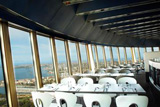
Sydney Tower

Taronga Zoo

Blue Mountains trip
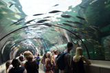
Sydney Aquarium
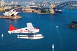
Seaplane flights